


Your fleet may already show every vehicle on a live map, yet managers still call drivers to confirm arrivals, security teams discover unauthorized movement after the fact, and site rules are applied differently from one branch to another. The problem is not missing location data. It is the absence of dependable geographic rules that can be applied by the tracking device whenever a vehicle enters, exits, or operates inside a defined zone.
This guide by Tracom explains how geofencing fleet management turns GPS data into controlled zone events for B2B fleets across the GCC and international markets. It covers geofence design, circular and polygon geofences, entry and exit logic, time-based speed controls, fleet geofencing alerts, KML and KMLO file management, device-group deployment, and the governance required to manage up to 4,000 zones without creating alert noise or configuration drift.
What does Geofencing add to GPS tracking?
Basic tracking answers where a vehicle is. Fleet geofencing adds a rule-based question: should this vehicle be inside, outside, entering, leaving, or operating at a specific speed within this location?
How does a geofence GPS tracker detect a zone event?
A geofence GPS tracker uses GNSS position data and an assigned digital boundary. The device or connected tracking environment compares the vehicle position with that boundary and generates a configured event when the required condition is detected.
- Entry into a depot, customer site, warehouse, port, project area, or approved parking zone.
- Exit from an operating area, security perimeter, or authorized route zone.
- Movement during a restricted time window.
- Speed above a zone-specific limit.
- Presence within a defined location for operational review.
- Travel outside an approved geographic area.
The event should include enough context to identify the vehicle, zone, time, position, and applicable rule. That technical evidence can then be displayed, stored, reported, or passed to another system according to the confirmed project scope.
Read also: How a GPS Fleet Tracking Device Works for Modern Fleets
What tracking device does not decide by itself?
A geofence event does not automatically determine whether a job is complete, whether a driver violated policy, who caused a delay, or which department must close the case. Tracom supplies the GPS device, local rule logic, event data, and configuration layer. The fleet or its connected business software assigns the operational meaning and response.
This separation matters when geofence data is connected to dispatch, ERP, transport management, safety, security, or customer-service workflows. A customer-site entry may support an arrival update, but it should not be presented as automatic proof of delivery unless the wider workflow validates that outcome.
Read also: How Fleet Dispatch Software Uses GPS Data for GCC and Global Fleets

Choosing the right geofence type
Geofence tracking accuracy begins with zone design. The correct boundary is not the most complex shape; it is the simplest shape that reflects the operational decision without including unrelated roads, properties, or access points.
Circular geofences for simple locations
A circular geofence uses a center point and radius. It is efficient for isolated depots, broad customer locations, parking areas, service facilities, and sites where exact property lines do not affect the decision.
Circles are faster to create and easier to maintain across many similar locations. Their limitation appears when the radius captures a nearby highway, neighbouring facility, or public access road and generates events that do not represent a real site visit.
Polygon geofence design for irregular sites
A polygon geofence uses several boundary points to follow an irregular site more closely. It is useful for ports, industrial compounds, construction projects, logistics terminals, large customer facilities, and restricted sections inside a wider operating area.
A polygon geofence should exclude unrelated traffic while retaining realistic tolerance around gates, parking areas, and loading points. Excessive detail can make the file harder to maintain and can increase boundary bounce when positioning varies near the edge. The final shape, point count, and device behaviour should therefore be validated during solution design.
Layered zones for approach, entry, and restricted areas
One location may require more than one boundary. A wider zone can identify approaches to a site, a smaller zone can confirm operational entry, and a separate polygon can protect a restricted loading, storage, or high-risk area.
Layered geofence zone management is especially useful when a single property contains several operational milestones. Each layer must have a different purpose and event rule; otherwise overlapping zones create duplicate fleet boundary alerts without adding useful evidence.
Zone Type | Best Fit | Main Risk | Design Rule |
Circle | Isolated depots, parking areas, simple customer sites | Capturing nearby roads or properties | Use the smallest practical radius with gate tolerance |
Polygon | Irregular compounds, ports, projects, industrial sites | Over-complex boundaries and edge bounce | Follow operational limits, not every property detail |
Layered zones | Approach, site entry, secure area, loading area | Duplicate events and unclear ownership | Give each layer one distinct business purpose |
High-Value Geofencing Use cases for GCC and global fleets
The strongest geofencing use cases connect one boundary event to one decision. GCC fleets often operate through ports, industrial zones, construction sites, remote corridors, depots, free zones, and cross-border networks, while global fleets face the same control problem across larger and more varied site portfolios.
Fleet Location | Device Event | Operational Use |
Depots and vehicle yards | Entry, exit, after-hours movement | Confirm return, detect unauthorized departure, or review release timing |
Customer sites and warehouses | Entry and exit timestamps | Support arrival visibility and site-duration review |
Ports, terminals, and border facilities | Zone transition and waiting-period records | Create a consistent timeline for operational review |
Construction and industrial sites | Polygon entry, restricted-area entry, zone-specific speed | Control access and reinforce site rules |
Approved parking and rest areas | Exit during restricted hours | Identify possible misuse or security exceptions |
Maintenance and inspection facilities | Entry and departure records | Support service-location visibility without claiming maintenance completion |
Multi-country or multi-branch fleets | Consistent zone categories and device-group rules | Apply the same control model across GCC and international operations |
Dwell time should be handled carefully. Entry and exit timestamps from the tracking device can support a dwell calculation, but appointment data, gate records, dispatch notes, cargo status, or customer terms may still be required to explain the delay and assign responsibility.
Read also: Trailer Fleet Tracking with Tracom GPS Device Data
Geofencing alerts and device-side rules
Fleet geofencing alerts become useful when the device rule, event priority, and expected response are defined before deployment. Sending every zone crossing as an urgent notification creates noise and weakens trust in the alert feed.
Entry, exit, and time-based Speed controls
Tracom supports real-time entry and exit notifications across customizable geofences. It also supports time-based speed limits, allowing a fleet to apply different speed rules inside a controlled area or during a defined operating period.
A lower speed rule may be appropriate inside a depot, customer yard, industrial site, pedestrian area, or project zone. The configured threshold must match the fleet’s documented policy and be tested with representative vehicles before it is deployed widely.
Grace periods and driver-facing voice alerts
Grace periods help distinguish a brief transition from a sustained exception. Where configured, driver-facing voice alerts can warn the driver during a geofence or speed condition, supporting immediate correction before the event becomes a larger operational issue.
The warning does not replace company policy or management review. It reinforces a predefined rule at the point of operation, while the recorded event remains available for later analysis or escalation.
Local decision continuity during coverage gaps
Tracom is positioned as an in-vehicle intelligence system, not a passive location transmitter. Device-side logic can continue applying configured rules when cloud communication is interrupted, while onboard storage protects trip and event records for later synchronization.
Device-side geofence detection and configured in-vehicle voice warnings can continue during a cellular communication interruption. Remote notifications, dashboard updates, and external workflow triggers still depend on connectivity and may be delayed until stored events are synchronized.
This is relevant for desert routes, tunnels, basements, ports, remote industrial sites, and international corridors where cellular coverage may be intermittent. The exact behaviour must be confirmed for the selected configuration and tested under the fleet’s real coverage conditions.
When a geofence event becomes a workflow trigger
A geofence event can act as an input to an external workflow when the connected platform supports the required event mapping. Job creation, driver assignment, proof of delivery, customer messaging, payroll actions, and case closure remain functions of the connected software, not the GPS tracker.
Read also: Fleet Safety Alert Management with Tracom GPS Devices

How to manage up to 4,000 geofences
Technical capacity does not guarantee operational control. A fleet can support thousands of zones and still fail if names are unclear, files are outdated, duplicate boundaries remain active, or device groups receive the wrong rules. The exact distribution of zones, device-group assignments, file structure, and applicable rule limits should be confirmed during solution design.
Build a zone taxonomy before uploading files
Every zone should have a unique identifier, category, purpose, owner, geographic reference, assigned vehicle or device group, active time window, applicable speed rule, event type, and review status.
Names such as ‘Zone 1’ or ‘Customer Site’ become unusable at scale. A structured format such as KSA-RUH-DEPOT-EXIT-EAST or UAE-DXB-CUSTOMER-LOADING-02 helps operations and technical teams identify the country, city, location type, function, and access point without opening the map.
Control KML and KMLO geofencing files through SCMS
Tracom’s SCMS portal supports centralized configuration management. Geofencing files can be prepared through KML-based structures, combined with custom speed categories, synchronized as KMLO data, and distributed to selected device groups.
This model is useful for multi-branch fleets because one approved configuration can be distributed consistently instead of recreated manually on each device. XML configuration files can also define detailed event behaviour, while over-the-air updates and selected SMS adjustments support controlled changes after deployment.
Review our Tracom Services for SCMS, Geofencing Files, OTA, and SMS Configuration
Use version control and a retirement process
When a customer moves, a project closes, a depot entrance changes, or a restricted area expands, the previous zone should be updated or retired. Leaving obsolete boundaries active creates false events and makes later investigations unreliable.
- Record the configuration version and approval date.
- Document which device groups received the file.
- Keep a change reason and responsible owner.
- Test the revised boundary before replacing the previous version.
- Retire duplicate, expired, and low-value zones on a scheduled review cycle.
Geofencing fleet management deployment workflow
A controlled rollout is more reliable than uploading hundreds of zones at once. The deployment sequence should validate the business decision, geographic boundary, device behaviour, alert output, and system responsibility before scaling across GCC or international operations.
- List the operational decisions that require geographic evidence, such as depot release, restricted-area entry, customer arrival, after-hours movement, or zone-specific speed control.
- Create a location register and classify each zone as operational, security, safety, parking, maintenance, or customer-facing.
- Choose the simplest suitable shape and define a realistic tolerance around gates, access roads, and loading areas.
- Assign the rule to the correct vehicle and device groups, operating days, time windows, and speed categories.
- Define the event output: driver voice warning, manager notification, stored milestone, report field, or integration input.
- Run a pilot across representative urban, highway, industrial, and weak-coverage conditions.
- Review missed events, edge bounce, duplicate alerts, incorrect assignments, and low-value notifications.
- Approve the final KML or KMLO structure, XML behaviour, recipients, and change-control process before fleet-wide distribution.
Before you scale, ask Tracom to validate the zone hierarchy, device groups, geofencing files, speed categories, and local rule logic against your actual routes and sites. Talk to a Tracom fleet specialist
Common geofence configuration failures
Most geofencing problems are not caused by the concept itself. They come from boundaries, rules, and ownership that were never designed for real operating conditions.
Failure | Operational Consequence |
Drawing zones without a decision | A boundary that does not trigger a defined review, warning, milestone, or report becomes unused map clutter. |
Using an oversized circle | Nearby roads or neighbouring properties may create false entry and exit events. |
Overengineering a polygon geofence | Too many points increase maintenance effort and can make edge behaviour harder to interpret. |
Sending every event to every manager | Routine arrivals compete with security exceptions and create alert fatigue. |
Treating a geofence event as job completion | Location evidence does not prove delivery, loading, service completion, or commercial responsibility by itself. |
Ignoring device-group assignment | A correct zone can still produce the wrong result when it is distributed to the wrong fleet, branch, or vehicle class. |
Skipping field validation | Map-based design cannot reveal every gate, nearby road, urban canyon, coverage gap, or reporting behaviour. |
Keeping obsolete zones active | Expired projects and relocated sites weaken historical records and exception review. |
Why Tracom fits large-scale geofencing fleet management
Tracom is built around the GPS tracking device and its configurable intelligence. The value is not a generic map boundary alone; it is the ability to apply approved geographic rules consistently across devices, preserve event evidence, and update configurations remotely as the fleet changes.
- Support for up to 4,000 customizable geofences.
- Real-time entry and exit notifications.
- Time-based speed limits and voice alerts during configured grace periods.
- Custom geofencing files using KML and KMLO structures.
- Centralized device grouping and configuration management through SCMS.
- Detailed XML event and behaviour configuration.
- Over-the-air firmware and configuration updates.
- Selected parameter changes through SMS when portal access is unavailable.
- Device-side rule application and onboard data continuity during communication interruptions.
The exact zone shape, point limits, event channels, device assignment, external interface, and connected workflow should be confirmed during project design. This keeps the proposal technically credible and ensures the geofencing setup matches the fleet’s real operating model. Review Tracom Fleet Tracking and Geofencing Features
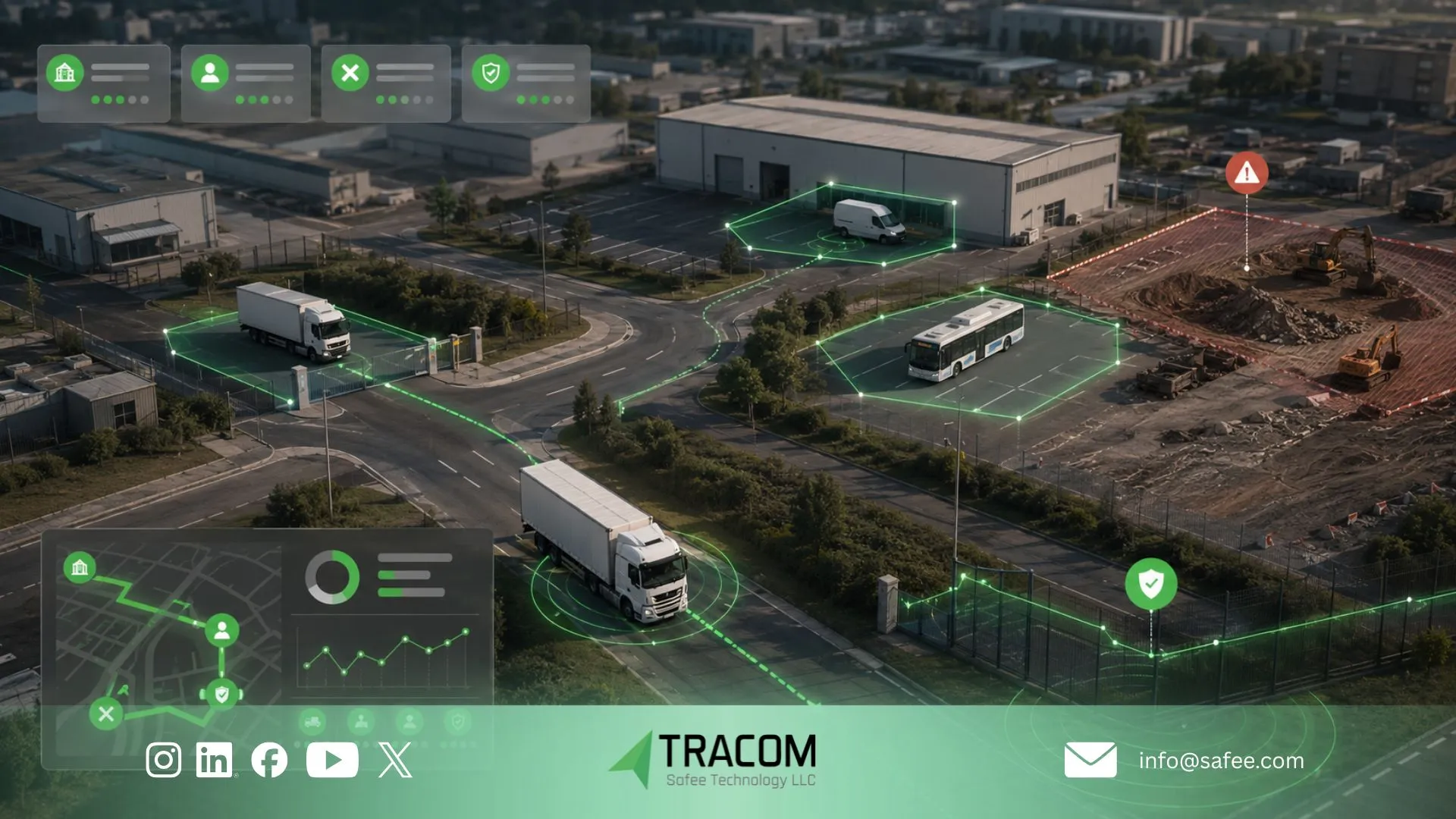
Turn fleet location into controlled zone evidence
Geofencing fleet management is most valuable when each digital boundary represents a real operating decision. A dependable setup combines practical zone design, device-side rule logic, controlled fleet geofencing alerts, clear device-group assignment, versioned KML or KMLO files, and a defined responsibility for every event.
For B2B fleets across the GCC and worldwide, Tracom provides the GPS device and configuration capabilities required to move beyond passive map tracking. The next step is to design the zones, speed rules, event outputs, and deployment process around your actual depots, customer sites, restricted areas, projects, ports, and vehicle groups.
Share your site list, vehicle groups, zone priorities, and integration requirements with Tracom to receive a practical geofencing deployment recommendation. Contact Tracom
FAQs about geofencing fleet management
What is geofencing fleet management?
Geofencing fleet management uses virtual geographic boundaries and GPS device data to detect when assigned vehicles enter, exit, or operate within defined areas. The resulting events can support security, site visibility, zone-specific speed control, reporting, and connected workflows.
How does a geofence GPS tracker generate fleet boundary alerts?
The tracker calculates the vehicle position, compares it with an assigned geofence, and applies the configured entry, exit, time, or speed rule. When the condition is met, the device or tracking environment generates an event containing the vehicle, zone, time, and position context.
What is the difference between a circular geofence and a polygon geofence?
A circular geofence uses a center point and radius and is suitable for simple or isolated locations. A polygon geofence follows an irregular boundary more closely, making it useful for ports, projects, industrial compounds, and sites beside unrelated roads or properties.
How many geofences can Tracom support?
Tracom supports up to 4,000 customizable geofences. The exact zone distribution, device-group assignment, file structure, rule configuration, and applicable technical limits should be confirmed during solution design.
Can geofence events trigger fleet workflows automatically?
They can provide inputs to connected systems when the integration supports the required event mapping. Automatic job creation, assignment, delivery confirmation, customer messaging, and case closure depend on the external platform and confirmed integration scope.